- Ph. D in 1996 and post graduation in 1991
- 1996-2001: Lecturer, M.S.University of Baroda
- 2001-2006: Scientist, Indian Space Research Organization (ISRO)
- 2006-2009: Assistant Professor at IITB
- 2009 -2014: Associate Professor at IITB
- Since 2014: Professor, IITB
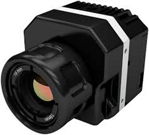
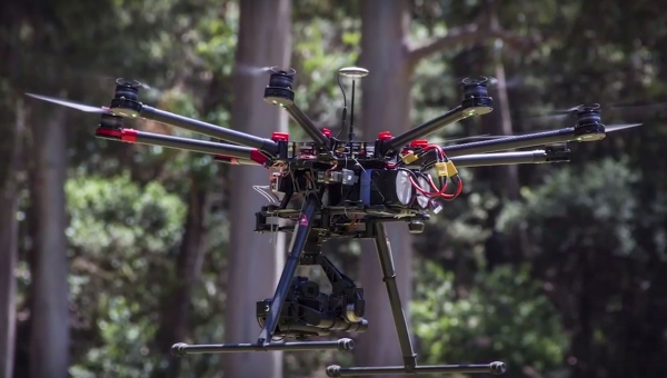
Unmanned Airborne Systems Developed
Ph.D
- Advanced Remote Sensing
M.Tech
- Remote Sensing, GIS and GPS
- Hyperspectral remote sensing for Earth System Sciences
M.Sc.
- Process Geomorphology & Remote Sensing
- Hydrogeology
- Member-Board of Governors : RGIPT, Ministry of Petroleum & Natural Gas, Government of India
- National Coordinator : DST Programme on Hyperspectral Remote Sensing and Applications
- Member : Committee on National Airborne Geophysical Mapping
- Member : UGC Committee on Deemed university accreditation
- Recipient of Hari Om Ashram Award for the year 1999 – 2000 & 2005-2006 in the field of Civil Engineering
- CSIR-Senior Research Fellowship award, 1998
- National Merit Scholar award for the year 1986 – 1991
Papers in Peer Reviewed Journals/Conference Volumes
- Roy,S.,Duttagupta,S.P and Ramakrishnan,D (2016) Effect of Interface Trap States on Optical Barrier Height of NiSi/Si Infrared Detector, Procedia Engineering 140, 203 – 208
- Rishikesh Bharti, Kalimuthu,R and Ramakrishnan,D (2015) Spectral pathways for exploration of secondary uranium: An investigation in the desertic tracts of Rajasthan and Gujarat, India. Adv.Space.Res. (In press).DOI 10.1016/j.asr.2015.07.015 (PDF)
- Rishikesh Bharti and Ramakrishnan,D (2015) Exploring the Unusual Uranium Enrichment Zones in the Thar Desert, India using Remote Sensing, GIS and Gamma-ray Spectroscopy, Remote Sensing Letters,6:7,509-518 (PDF)
- D. Ramakrishnan and Rishikesh Bharti (2015) Hyperspectral Remote sensing and Geological Applications, Cuirrent Science, 108(5), 879-891.(PDF)
- R.Bharti and D.Ramakrishnan (2014) Uraniferous calcrete mapping using hyperspectral remote sensing, DOI: 10.1109/IGARSS.2014.6947083 (PDF)
- Sandipta, R., Duttagupta,S., and D.Ramakrishnan (2014) Nano-scale NiSi and n-type Silicon based Schottky barrier diode as a NIR detector for room temperature operation, Jour. Applied Physics ,116, 124507 (2014); doi: 10.1063/1.4896365 (PDF)
- Roy,S., Dattagupta,S. and Ramakrishnan,D (2014) CO2 detection using Al/Si Schottky diode by IR spectroscopic technique, IEEE-Xplore DOI 10.1109/CIEC.2014.6959083(PDF)
- D. Ramakrishnan, R.Bharti and Das, M (2014)Reply to Comment on “A technique for estimation of suspended sediment concentration in very high turbid coastal waters: An investigation from Gulf of Cambay, India, Marine Geology, 351,109-111 (PDF)
- Rishikesh Bharti, Ramakrishnan, D and Singh, K.D. (2014) Compositional Diversity of Naonobu Crater Area: Inferences from Chandrayaan-1 Moon Mineralogy Mapper (M3) Data, Jour. Earth System Sciences ,123(1),233-246. (PDF)
- D.Ramakrishnan (2014)
Spectral Discrimination of Recent sediments around Bhuj, India using Landsat-TM data and assessment of their vulnerability to seismicity related failures. Natural Hazards, 70:485-499 (PDF) - Ramakrishnan, D.,Rishikesh Bharti, Das,M. (2013) A Technique for estimation of suspended sediment concentration in very high turbid coastal waters: An investigation from Gulf of Cambay, India. Marine Geology,3 46,256-261(PDF)
- Keshav Dev Singh,Ramakrishnan Desikan and Lalu Mansinha (2013) A comparative study of various transformation and sparse techniques for automated endmember extraction and abundance estimation from hyperspectral data,Vibrational Spectroscopy (Under Review)
- Vinuchandran, R and Ramakrishnan,D (2013 )Detection of Fronts from Ocean Colour Monitor Images using Entropic Technique: A case study of meso- and micro-scale chlorophyll mapping in Bay of Bengal, India, Adv. Remote Sensing,2013 (2),71-76.
- Ramakrishnan,D. Rishikesh Bharti, Singh,K.D. Nithya, M. (2013) Thermal Inertia Mapping and its Application in Mineral Exploration: Results from Mamandur Poly Metal Prospect, India. Geophysical Journal International,DOI:10.1093/gji/ggt237(PDF)
- D. Ramakrishnan, T.N.Singh, A.K. Verma, Akshay Gulati and K.C.Tiwari (2013) Soft Computing and GIS for landslide susceptibility assessment in Tawaghat area, Kumaon Himalaya, India. Natural Hazards, 65:315-330 (PDF)
- D. Ramakrishnan, Nithya M. Keshav Dev Singh, Rishikesh Bharti (2012) A Field Technique for Rapid Lithological Discrimination and Ore Mineral Identification: Results from Mamandur Polymetal Deposit, India. Jour. Earth System Sciences,122(1),1-14.[PDF]
- Rishikesh Bharti, D.Ramakrishnan, K.D.Singh and Nithya M (2012) Significance of Mineral Texture on Bidirectional Reflectance and Emission Spectroscopy: Implications for Geological Remote Sensing, IEEE-Xplore, DOI:10.1109/IGARSS .2012.6350783
- K.D.Singh, D.Ramakrishnan and Lalu Mansinha (2012) Transformation Techniques in Rapid Endmember Identification and Spectral Unmixing: a Hypespectral Remote Sensing Perspective. IEEE-xplore. DOI:10.1109/IGARSS. 2012.6350516
- D.Ramakrishnan, Kusuma K.N., Rishikesh Bharti and Das,M (2012) Relevance of Spectroscopic Approach in the Retrieval of Suspended Sediment Concentration (SSC) in Case-II waters: An Investigation in the High Turbid waters of Gulf of Cambay, India. IEEE-xplore. DOI:10.1109/ IGARSS.2012.6352531
- K.D.Singh, D.Ramakrishnan and Mansinha,L.(2012) A novel method for automatic minerals identification and their abundance estimation for rock type discrimination using hyper-spectral data. IEEE-Hyperspectral Image and Signal Processing. (Accepted)
- Kusuma,K.N., Ramakrishnan,D . and Pandalai,H.S.(2012) Spectral pathways for effective delineation of high-grade bauxites: a case study from the Savitri River Basin, Maharashtra, India, using EO-1 Hyperion data, International Journal of Remote Sensing, Vol. 33 (22), pp. 7273–7290. [PDF]
- Ramakrishnan,D. Nithya, M. Bharti,R., Kusuma,K.N and Singh,K.D(2012) Measurement of thermal properties of select intact and weathered granulites and their relationship to influence properties, Geophysics, 2012, 77(3), 1-11. [PDF]
- Kusuma,K.N., Ramakrishnan,D ., Pandalai, H.S. and Kailash,G.(2010) Noise reduction in field spectroradiometer data – the “noise-signal index threshold” and its significance in hyperspectral image classification: A case study of laterite, lateritic-bauxite and bauxite mapping. Geocarto International, vol.25(7),569-580. [PDF]
- Ramakrishnan,D ., Bandopadady,A and Kusuma,K.N (2009) SCS-CN and GIS-based approach for identifying potential runoff harvesting sites in the Kali watershed, Mahi River basin, India, Jour. Earth System Sciences, vol.118(4),355-368. [PDF]
- Chowdary, V. M., Ramakrishnan,D ., Srivastava, Y. K., Vinu Chandran,R., and Jeyaram, A. (2009)Integrated Water Resource Development Plan India using Remote Sensing and GIS, Intl. Jour. Water Resource Management, vol. 23, 1581-1602. [PDF]
- Ramakrishnan,D . T.N.Singh, Barde,K. and Gupta,S.(2008) Artificial Neural Network and Liquefaction Susceptibility Assessment: A case study using the 2001 Bhuj Earthquake data, Gujarat, India. Intl. Jour. Computational Geosciences, vol.12, 491-501. [PDF]
- Chowdary, V.M., Neeti, Vinu Chandran.R., Ramakrishnan,D . Dutta,D., Bothale,R.V., A.Jeyram., Sharma,J.R. and Jayaraman,V. (2008) Assessment of surface and sub surface waterlogged areas in irrigation command areas of Bihar state using Remote Sensing and GIS. Intl. Jour. Agricultural water management, vol.95(7), 754-766. [PDF]
- Ramakrishnan,D ., Durgarao, H.V., Tiwari,K.C.(2008)Integrated approach of Remote sensing and GIS in delineation of sites for water harvesting structures, Kali watershed, Dohad, Gujarat, India. Geocarto International, Vol. 23(2), 95–108. [PDF]
- Ramakrishnan,D ., K.K. Mohanty, Nayak,S.R. and Vinu chandran,R.(2006) Mapping the Liquefaction induced soil moisture changes using Remote Sensing and GIS: An approach to map liquefaction susceptible areas around Bhuj, India. Intl. Jour. Engg. Geology & Geotech. Engg.vol.24, 1581-1602. [PDF]
- K.C.Tiwari, S.Ganapathi, A.Mehta and Ramakrishnan,D . (2006) Landslide hazard zonation of Tawaghat-Jipti route corridor, Pithoragarh, Uttaranchal State: using GIS and probabilistic technique approach. Int. Soc. Optical Engineering (SPIE), Vol. 6412, 64120Q. [PDF]
- Ramakrishnan,D ., K.C.Tiwari (2006)Calcretized-Ferricretes Around Jaisalmer Area, Thar Desert, India: Their Chemistry, Mineralogy, Micromorphology and Genesis. Tubitak :Turkish Jour. of Earth Science, vol. 15 (2), 1-13 [PDF]
- Ramakrishnan,D ., Ghosh, M.K., Vinuchandran, R. and Jeyaram, A. (2005)Probabilistic Techniques, GIS and Remote Sensing in Landslide Hazard Mitigation: A case Study from Sikkim Himalayas, India. Geocarto International. Vol. 20 (4), pp 1-6. [PDF]
- Vinuchandran, R., Ramakrishnan,D ., Chowdary,V.M., Jeyram, A., (2005) Flood inundation mapping and Analysis using Airborne Synthetic Aperture Radar: A case study from 2004 floods, Bihar. Current Science, vol.90 (2), pp 2-8. [PDF]
- Ramakrishnan,D ., S.K.Ghosh, V.K.M.Raja, R.Vinuchandran, A.Jeyram (2005)Trails of the Killer Tsunami: A Preliminary Assessment using Satellite Remote Sensing and GIS techniques. Current Science, vol.88 (5), pp.709-712. [PDF]
- Ramakrishnan,D ., with Shah.S.,Shroff.A.V.and Tiwari,K.C.(2003) Stabilization of Fuel Oil Contaminated Soil – A Case Study from Vadodara District, Gujarat India. Intl. Jour. Engg. Geol. & Geo-technical Engg. Vol.21, (2003), pp.415-427. [PDF]
- Ramakrishnan,D ., K.C.Tiwari. (1999)Calcretic and ferricretic duricrusts of the Thar Desert, India: their geo-technical appraisal as a road paving aggregate. Intl. Jour. Engineering Geology, vol. 53, , 13-22p. [PDF]
- Ramakrishnan,D ., K.C.Tiwari. (1998) REE Chemistry of Arid zone calcrete profiles- A case study from the Thar desert, India. Tubitak: T. Jour. of Earth Sciences, vol.7 (2), pp.97-103. [PDF]
- Ramakrishnan,D ., K.C.Tiwari. (1998) Calcretes : Geotechnical appraisal and efficacy as an alternative pavement material for the desertic roads of Western India. Jour. Geol. Soc. India, vol.51, pp.103-107.
- Ramakrishnan,D ., K.C.Tiwari. (1997)Role of pedogenesis and neo-formations in dune stabilization. A case study from Barmer district, Rajasthan, Bull. Pure & Appl. Sci. vol.16 F(1&2), 23-31pp.
- Ramakrishnan,D ., K.C.Tiwari. (1996) Impregnation of friable sediments using solvent cement – A new standard method. Jour. Geol. Soc. India. Vol. 48 (3), pp.589-590.
- K.C.Tiwari, Ramakrishnan,D .. (1995) Occurrence of Early Pliestocene Continental Quaternary Sediments in Lower Luni Valley, Western Rajasthan. Proc. Nat. Sem. on Rec. Researches in Geol. W. India. M.S.Univ. Baroda. pp.125-132.
Chapters in Books/Manual :
- Ramakrishnan,D and Kusuma,K.N.(2008)
Marine Clays and its Impact on the Rapid Urbanization Developments: A Case study of Mumbai Area Using EO-1-Hyperion data. In: Hyperspectral Remote Sensing and Spectral Signature Applications (Rajendran et.al Eds.), New India Publications, New Delhi, 370p. (ISBN: 9788189422349). - Ramakrishnan,D. (2008)
An Integrated approach of Remote Sensing, Geotechnical engineering and Artificial Neural Network in evaluation of liquefaction susceptibility of Kachchh region, Gujarat India. In: Natural and Man-made Disasters: Anticipation and Mitigation, (Singh,K.K. Ed.), M.D.Publications Pvt.Ltd., New Delhi. - Ramakrishnan,D (2006)
“Remote sensing and GIS tools in earthquake hazard mitigation and management: An illustration from Bhuj earthquake 2001”. Training Handbook for Municipal / PWD/ Private Sector Engineers of the States and UTs. National Programme for Capacity Building of Engineers in Earthquake Risk Management (NPCBEERM), National Disaster Management Division, Govt. of India.
Papers in Conferences/Symposium
- M.Nithya, D.Ramakrishnan, Rishikesh Bharti , K.D.Singh (2012) Potential of Remote Spectroscopy and Thermal Inertial Studies in Base metal Exploration: Inferences from Mamandur prospect, India. Proc.International Conference on Geospatial Technologies and Applications, 26-29th February 2012, I.I.T Bombay, Mumbai
- K.D.Singh, D.Ramakrishnan and L. Mansinha(2012) A Novel Method for Automatic Minerals Identification and their Abundance Estimation for Rock type Discrimination using Hyperspectral data . Proc. National Workshop on Wavelets, Multiresolution and Multifractal Analyses in Earth, Ocean and Atmospheric Sciences, Feb 29 – Mar 02, 2012, IIT Bombay
- D.Ramakrishnan, Radhika Narayanan, K.D.Singh and R.Bharti (2011) A Fast Procedure for Field and Satellite Spectral Deconvolution and its Ramification in Automated Detection of Materials, Proc.GeoSummit-2011, 27-29 July, 2011, Sathyabhama University, Chennai.
- Ramakrishnan,D.(2008) Adaptive segmentation and ANN: A Hybrid algorithm in analysis of HYPERION satellite data for Bauxite resource mapping. Proc. National Seminar on Hyperspectral Remote Sensing and Spectral Signature database Management System,14-15 Feb,2008, Annamalai University,Chidambaram
- Kusuma,K.N., Pandalai,H.S. and Ramakrishnan,D. (2008), The distribution of laterites in Savitri River basin, India- Remote Sensing and GIS based study. Proc. Intl. Conference on Tectonics of the Indian Subcontinent, 3-6 March, IIT Bombay, Mumbai.
- Ramakrishnan,D., Vinuchandran, R and Jeyram, A. (2004) Evidences of Last Glacial Maximum (LGM) in the higher Himalayas: A case study from Sikkim Himalayas. Proc.ISRS Annual Convention and National Symposium, 3-5, November 2004, Jaipur, India.
- Ramakrishnan,D., Mohanty, K.K.,Nayak, S.R and Jeyaram, A.(2003) Mapping The Liquefaction Susceptible Zones in Parts of Kachchh Region Using IRS — WiFS and LISS-3 Data. Intl. Workshop on Earth system Process related to Gujarat Earthquake using Space Technology, 27-29th January,2003, Indian Institute of Technology, Kanpur, India.
- Ramakrishnan,D. and K.C.Tiwari(1999) Identification of non-traditional pavement aggregates for roads in Thar desert, India, Intl. Symp. On Engineering Geology and Natural Disaster with emphasis on Asia”, 28-30, Sep., 1999, Kathmandu, Nepal
- K.C.Tiwari, Ramakrishnan,D. (1995) Occurrence of Early Pliestocene Continental Quaternary Sediments in Lower Luni Valley, Western Rajasthan. Proc. Nat. Sem. on Rec. Researches in Geol. W. India. M.S. Univ. Baroda. 125-132.
- Ramakrishnan,D. (1995) Occurrence and mode of deposition of Early Pleistocene Deposits in the Lower Luni Valley, Western Rajasthan, India. Intl. Conference on Quaternary Deserts and Climatic Changes, Apr.1995,UAE, Saudi Arabia.
- Ramakrishnan,D. (1994) Pedogenesis and Stabilization of Parabolic dunes around Dhanola, Barmer District, Rajasthan. Nat. Symp. on Quaternary Deposits of India. University of Chandigarh, Nov.,1994 Chandigarh.
Areas of Research Interests
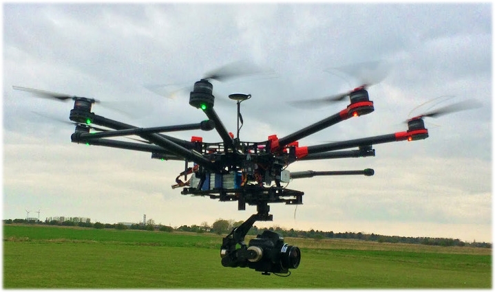
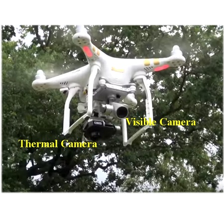
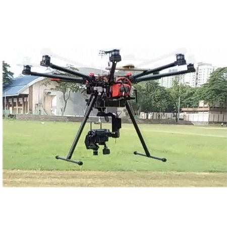
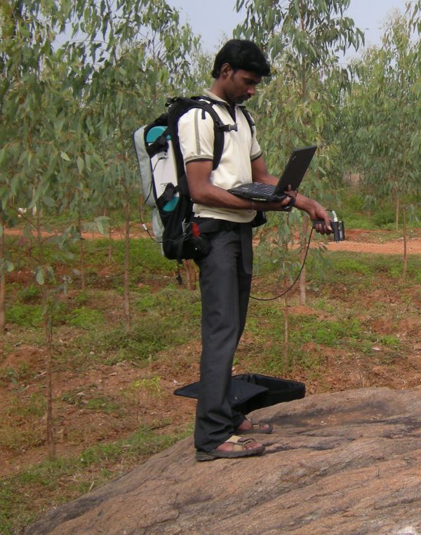
- Unmanned Airborne Systems and Robatic Platforms for image acquisition (Click here for video)
- Visible, near and far Infra-red Imaging Spectroscopy for mineral and Hydrocarbon exploration
- Thermal properties of natural and man-made surfaces
- Algorithm development for hyperspectral and Thermal Image analyses
- Planetary Analogue studies
- Geospatial Modelling
Research Grants
- Lithological Discrimination and Mineral Potential Mapping of Mamandur Poly Metal Sulphide Zone, Tamil Nadu: An Imaging Spectroscopy Perspective (Funding Agency: Department of Science & Technology, Govt. of India)
- Spectral Signature Development and Analysis of Select Natural and Man Made Earth Surface Features for their Diagnostic Surface Differentiation. (Funding Agency: Department of Science & Technology, Govt. of India)
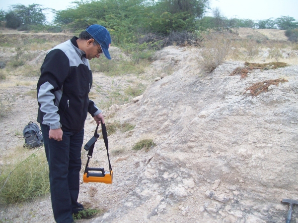
- Application of imaging spectroscopy and thermal remote sensing techniques in delineating palaeo-channel related Calcretes; an investigation in parts of Rajasthan and Gujarat for Carnotite exploration (Funding Agency: Indian Space Research Organisation (ISRO)
- Simulation of Lunar Reflectance Spectra using Radiative Transfer Modeling and Spectroscopy of Lunar Analogues (Funding Agency: Indian Space Research Organisation (ISRO)
- Primary and Secondary Information Retrieval of Select Man- Made Surface Features using Hyperspectral Remote Sensing Technique: Defense Research Development Organisation
- Generation of Pragmatic Spectral Database for minerals and rocks in reflective and emissive region: Department of Science and Technology, Govt. of India
(1) D.Ramakrishnan (2012)
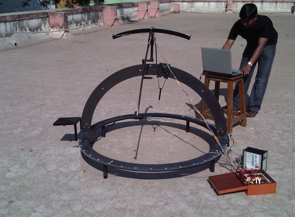
Wide-field goniometer for spectroscopic measurement of albedo and emissivity in laboratory and field
(2) S. Roy, S.Dattagupta and D.Ramakrishnan (2013)
Aluminum silicide schottky diode for outdoor methane detection in hostile environment by spectroscopic technique
(3) S.Roy, S.Dattagupta and D.Ramakrishnan (2014)
A methane detection device for sensing the presence of methane gas in an aqueous environment
Network project on Hyperspectral Remote Sensing and Applications
Role : National Coordinator
Budget : 24 Crores
About : Carrying out research involving application of Hyperspectral Technique in various fields and development of methodologies for practical applications. In all, six major areas viz.Geology, Agriculture, Forestry, Water resource, Snow & Glacier, Urban and Built Environment, Algorithm Development are identified and each theme will have 5 objectives to address. Each objective is a research project headed by an investigator.The chosen objectives are generic and has relevance to inter and intra theme application potentials. The algorithm theme will address the needs of all other thematic areas and also generate tools for hyperspectral data processing and analyses.
In addition, the networked project also has scope for airborne data acquisition, database management and sharing among the user community.
Establishment of regional laboratory facilities (at North, East, South and Western part of the country) comprising critical equipments relevant to research in above themes is also part of this networked project.
Development of human resource in this emerging area is also addressed by means of conducting training programmes and workshops.
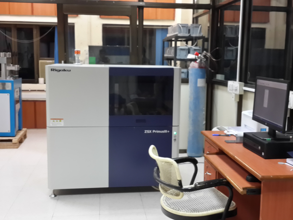
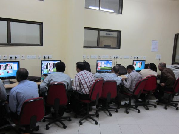
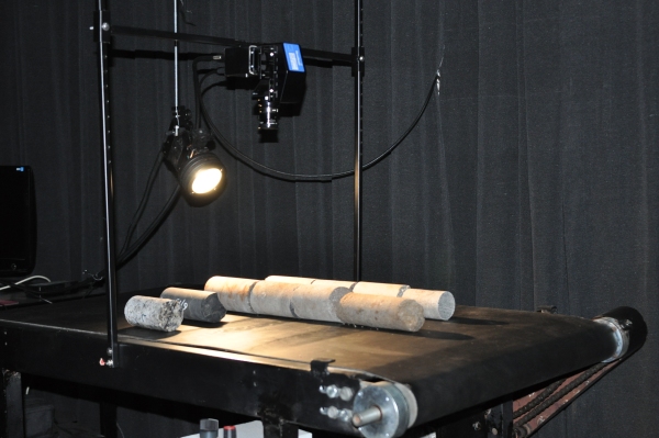
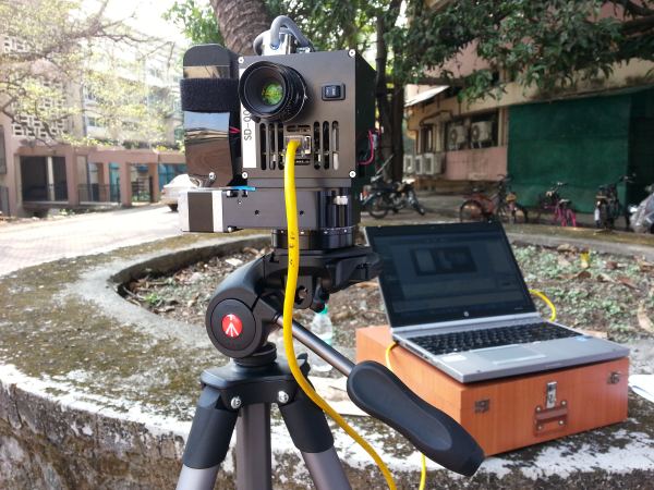
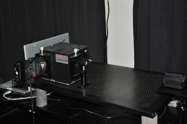
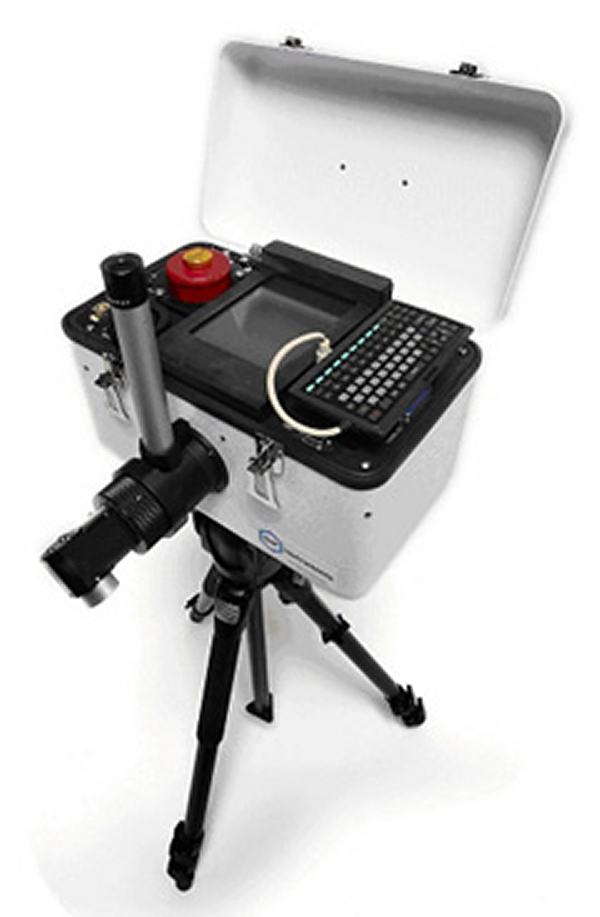
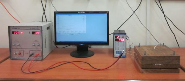
Remote Sensing Lab
HYPERSPECTRA -2013 (CLICK HERE)
HYPERSPECTRA-2011(CLICK HERE)